
Mapping
Aerial surveys and mapping for land management, timber assessment, and property planning — precise data you can actually use.
See Your Property From Above
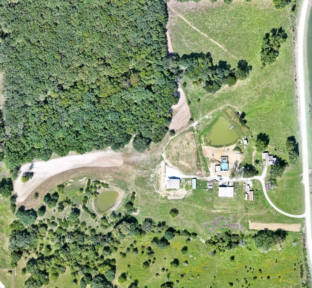
Whether you’re planning trails, assessing timber, evaluating a property before you buy it, or just want an accurate picture of your boundaries and terrain, an aerial survey gives you information ground-level walkthroughs can’t. We fly your property and stitch the imagery together into a single high-resolution orthomosaic map you can use for real planning decisions.
Mapping pairs naturally with our herd analysis service — many landowners have us do both in the same visit, combining a property survey with a wildlife count for a complete picture of the land.
- Delivered as a single stitched orthomosaic map of your full property
- Provided as a GeoTIFF (.tif) file, compatible with GIS and mapping software
- High-resolution aerial imagery of your entire property
- Useful for land management, timber, and trail planning
- Helpful reference before purchasing or listing land
- Can be paired with a herd analysis flight in the same visit
Print Options
Choose Your Map Material
Your aerial map isn’t just a digital file — we can print it in the material that fits how you’ll actually use it.
Paper
A lightweight, affordable poster print — ready to frame or pin up in the cabin, shop, or office.
Canvas
A durable, gallery-style canvas print that turns your property into a striking piece of wall art.
Magnetic
Printed on a thin magnetic sheet and paired with a set of movable pegs, so hunters and outfitters can mark and re-mark stand locations, food plots, trail cameras, and more right on the map as the setup changes through the season.
See The Difference
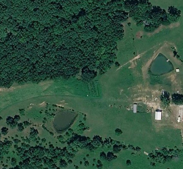
Google Earth vs. Recon1 High-Resolution Mapping
Drag the slider to compare a standard Google Earth satellite view against the high-resolution orthomosaic map we deliver from an actual flight over the same property.
 Google Earth
Recon1 High-Res
Google Earth
Recon1 High-Res
Request A Mapping Flight
Tell Us About Your Property
Fill out the form below and we’ll respond as soon as possible — or call/text us directly at (660) 223-8773.
Other Services